This visual record documents the transformation of landscape patterns in Mataró, situated within the Barcelona metropolitan region. The comparative imagery captures the territorial evolution across a fourteen-year period, from 2000 through 2014.
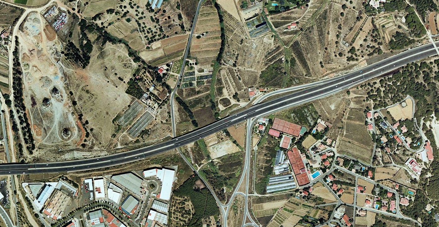
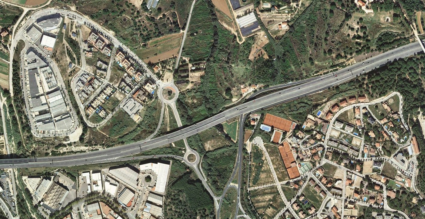
Slide to compare aerial imagery: 2000 versus 2014
The photographic evidence reveals significant modifications to the land use patterns during this interval. Agricultural and open space areas visible in the earlier timeframe have undergone conversion to built infrastructure, including residential development zones and transportation corridors.
The transformation includes the construction of road networks characterized by circular junction designs, exemplifying the suburban expansion patterns documented throughout the Catalan coastal region during this development cycle.