January 29, 2014
Alcora, Castellón Province
This comparative documentation captures the territorial evolution of Alcora in the Castellón province, demonstrating the notable changes in land use patterns observed over a fifteen-year period.
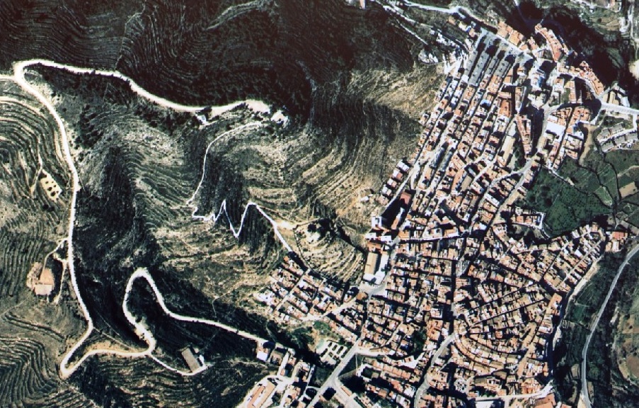
1997
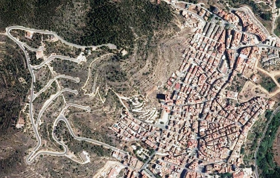
2012
The aerial imagery presents a clear record of urban expansion within this municipality located in the ceramic production region. The photographs document the conversion of agricultural and undeveloped land into built environments between the late 1990s and early 2010s.
These visual records serve as evidence of the broader patterns of territorial modification that characterized this era across the Spanish landscape, particularly in areas experiencing economic growth linked to industrial development and real estate expansion.