This visual documentation captures the territorial evolution of Azuqueca de Henares, a municipality in the province of Guadalajara. The comparative analysis spans an eight-year period, revealing significant alterations to the landscape configuration.
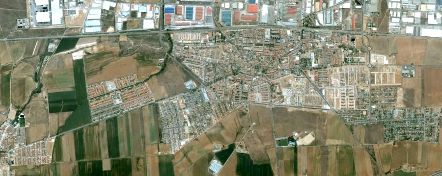
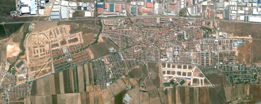
The aerial imagery documents the transformation of agricultural terrain into urbanized zones. This visual record illustrates the expansion patterns characteristic of Spanish municipalities during the early 21st century development cycle.
The before-and-after comparison reveals the spatial reorganization of land use, marking the transition from rural to residential and commercial functions. These images serve as archival evidence of landscape modification during a significant period of territorial change.