This comparative visual documentation captures the territorial transformation of Balerma, a coastal settlement in Almería province. The satellite imagery reveals the evolution of infrastructure and built environment over a thirteen-year interval.
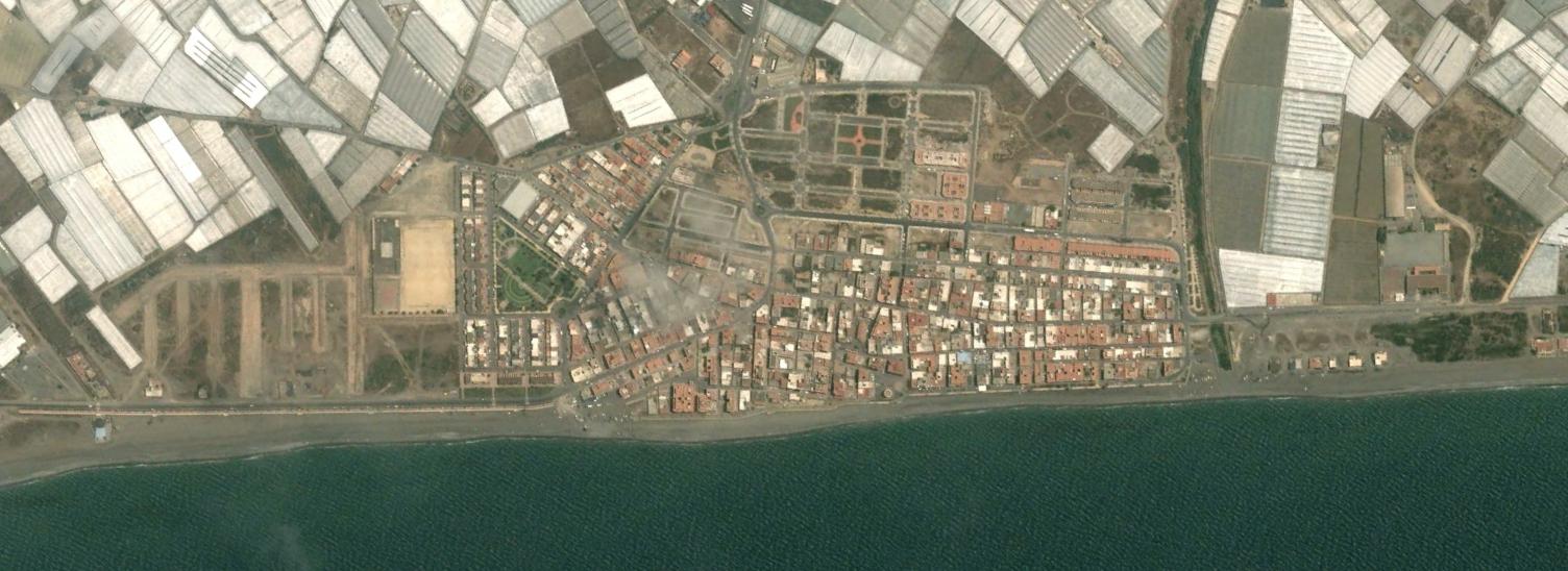
The "before" image from 2003 presents the coastal zone with limited road infrastructure connecting to the agricultural hinterland. By 2016, the "after" view documents the introduction of roundabouts and expanded roadway networks, characteristic of development patterns observed across Mediterranean coastal regions during this period.
The transformation reflects broader trends in Spanish coastal urbanization, where traffic infrastructure projects accompanied residential expansion in previously agricultural or undeveloped areas. This visual record serves as evidence of the physical footprint left by development policies implemented during the early 21st century.