Visual documentation of landscape transformation in the municipality of Cistérniga, located in the province of Valladolid. The comparative imagery captures territorial changes observed between 2006 and 2015, illustrating patterns of urban expansion and infrastructure development characteristic of this period.
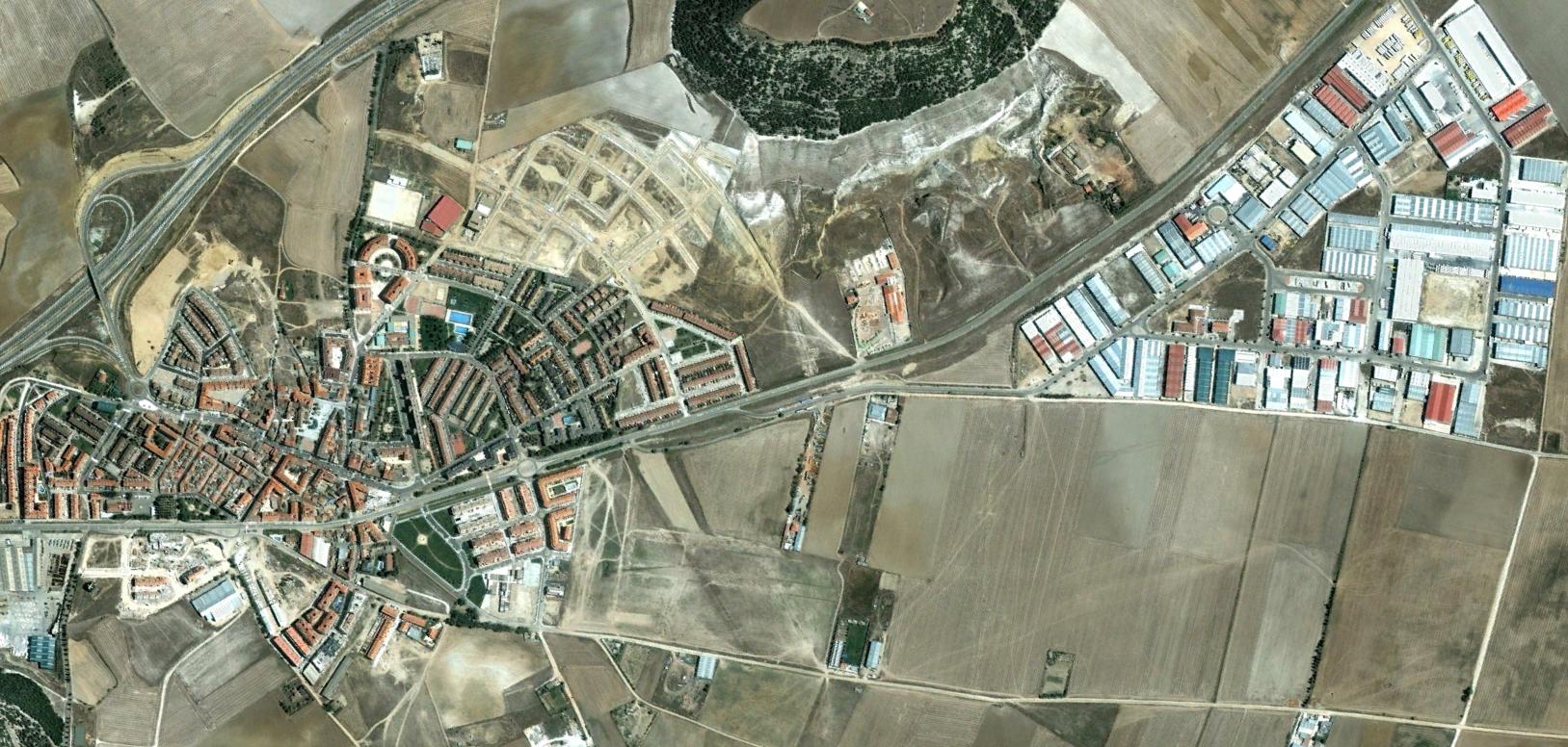
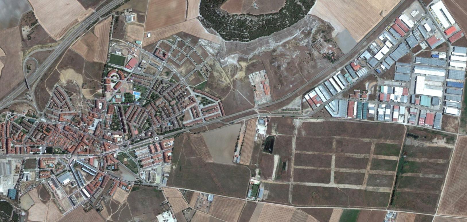
The photographic record reveals the conversion of agricultural land into developed areas, documenting the progression of built environment and road networks across this section of the Castilian landscape.