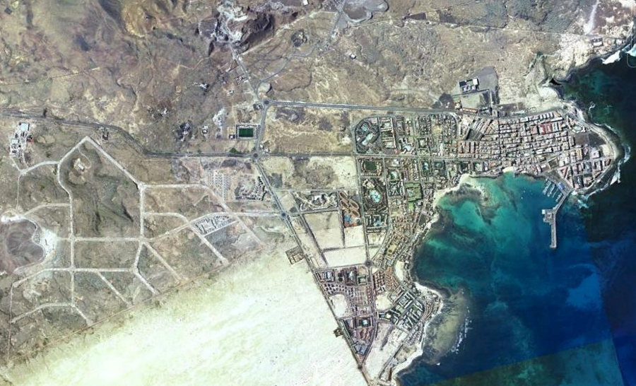
Visual documentation of coastal development transformation in Corralejo, located within the municipality of La Oliva in Fuerteventura, province of Las Palmas. The comparative imagery illustrates landscape modification patterns over a decade-long observation period.
2002
2012
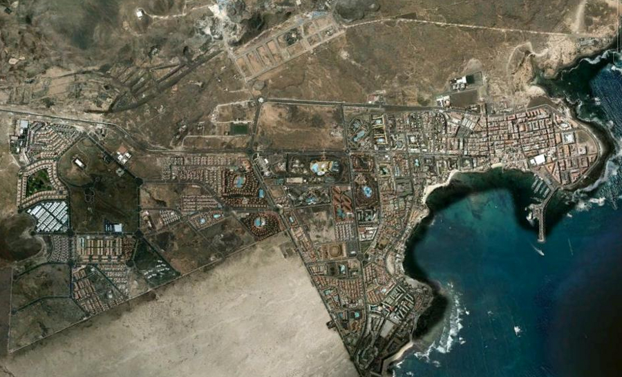
The images capture territorial change along the coastal zone adjacent to protected natural areas, documenting the expansion of built environments over the documented timeframe. This comparative analysis forms part of a broader inventory examining land use transformation patterns across Spanish territories during the early 21st century.