Visual documentation of landscape transformation in Gerindote, a municipality in the province of Toledo. The following images capture the territorial changes between 2002 and 2012, revealing patterns of development characteristic of the period.
2002
2012
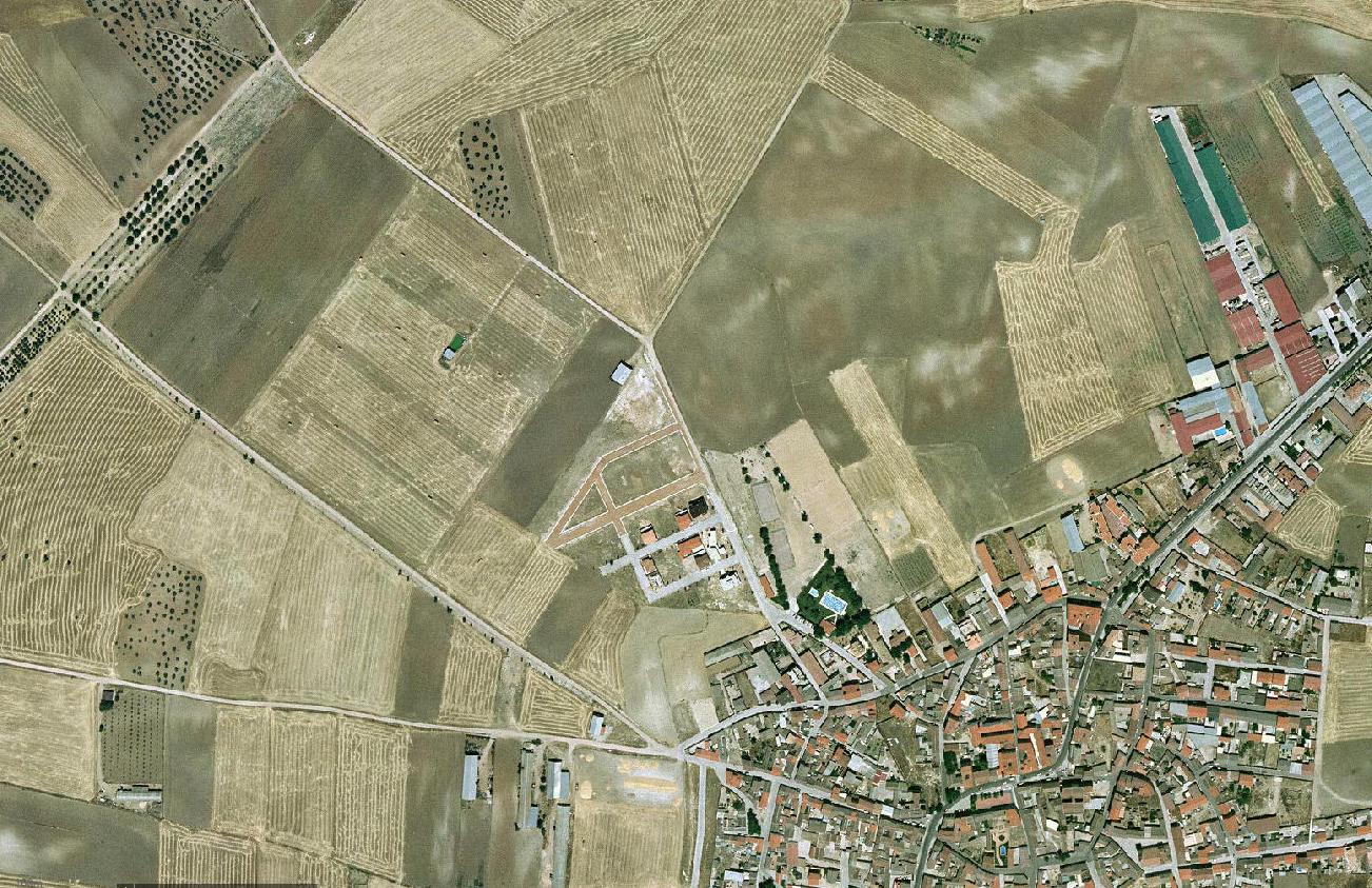
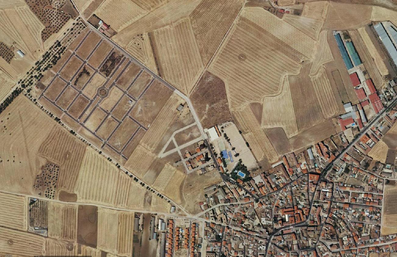
The comparative analysis illustrates the extent of infrastructure expansion and land use conversion that occurred during this decade-long timeframe.