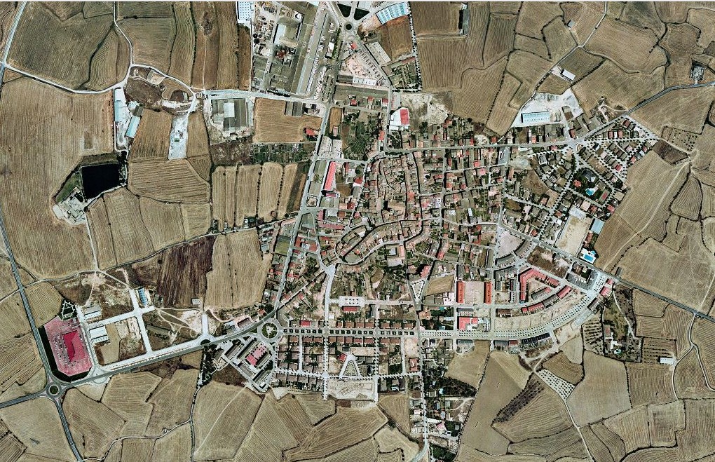
This visual documentation captures the landscape evolution in Guissona, Lleida province, revealing the physical transformation of the territory over an eleven-year period. The comparative imagery illustrates shifts in land use patterns and infrastructural development typical of early 21st-century Spanish urban expansion.
2001 - Pre-development aerial perspective
2012 - Post-development aerial perspective
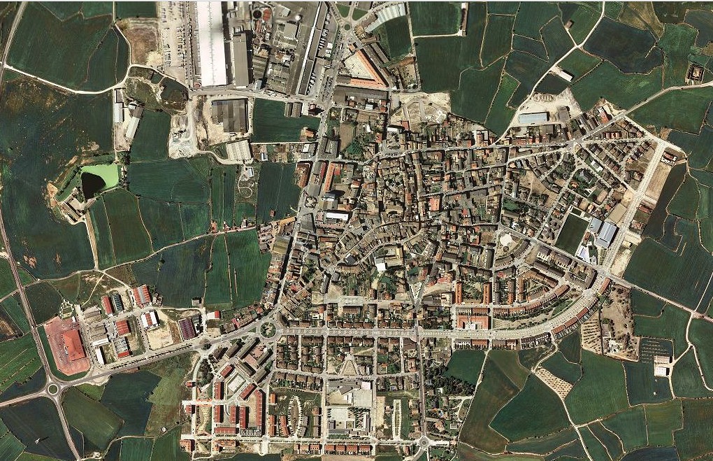
The photographic evidence documents notable alterations in the regional topography, with visible modifications to circulation infrastructure and land parceling characteristic of the documented period.