La Estación de El Espinar, Segovia
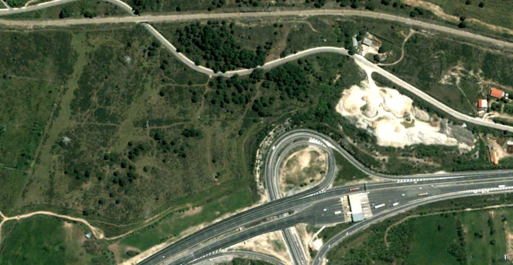
Before: 2004
After: 2016
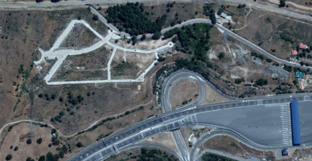
This comparative documentation captures the transformation of the landscape surrounding La Estación de El Espinar in Segovia province. The imagery reveals notable alterations in land use patterns and infrastructure development between the years 2004 and 2016.
The earlier photograph displays a predominantly open landscape with minimal constructed features. By 2016, the same location exhibits increased development density, with visible road infrastructure including circular traffic elements characteristic of modern highway systems. This visual evidence demonstrates the territorial modifications that occurred during this twelve-year period.
Such before-and-after comparisons serve as factual records of landscape evolution, documenting the physical changes that accompany urban expansion and infrastructure projects in Spanish territories.