Los Ángeles de San Rafael Golf, Segovia
The landscape near San Rafael in Segovia province underwent substantial modification between 2004 and 2016. This comparative documentation captures the transformation of previously undeveloped terrain into an organized golf resort development.
Territorial Change Documentation
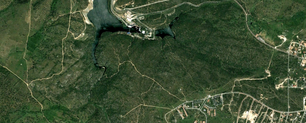
2004
The area displayed natural topography with minimal human intervention, characterized by open fields and scattered vegetation patterns typical of the Castilian plateau.
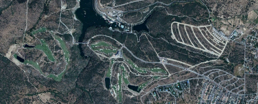
2016
By this date, the terrain featured structured golf facilities, access roads with circular junctions, and residential parcels integrated within the landscape design.
Observational Notes
The aerial imagery reveals the systematic conversion of rural landscape into recreational infrastructure. The development introduced geometric patterns of fairways, greens, and landscaped areas that contrast with the surrounding natural topography.
Road infrastructure expanded to accommodate access requirements, featuring the characteristic roundabout intersections common to Spanish suburban development of this period. The residential component integrated into the golf landscape represents a planning model that gained prominence during the early 2000s construction boom.
This visual record documents a specific moment in Spanish territorial transformation, capturing the physical manifestation of urban expansion patterns that characterized the pre-2008 development cycle.