This visual documentation captures the transformation of the Méndez Álvaro district in Madrid between 2000 and 2017. The comparative imagery reveals significant changes in the urban landscape over this seventeen-year period.
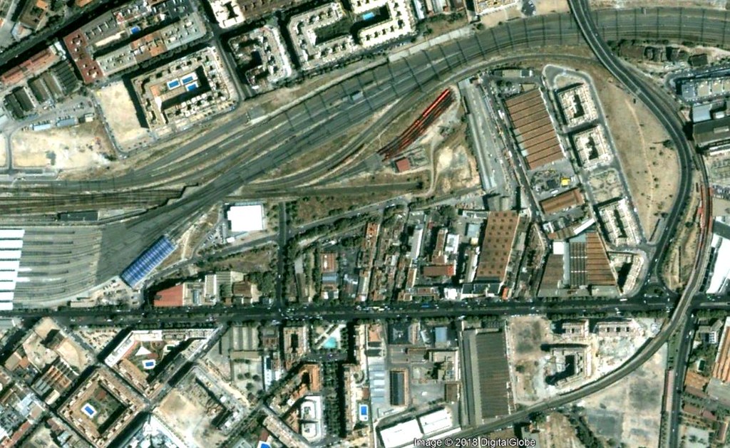
2000
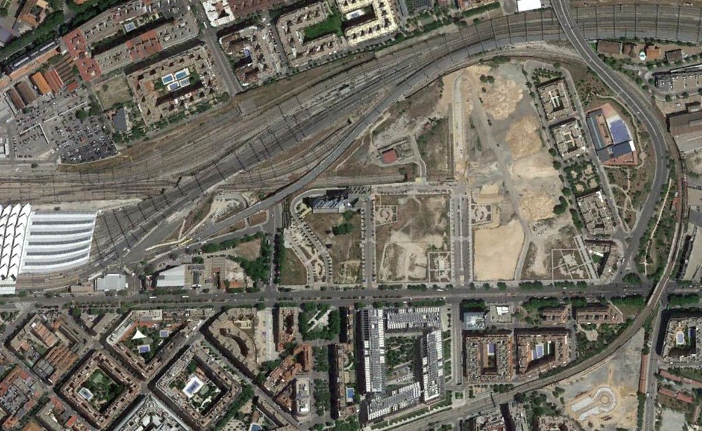
2017
The photographic evidence documents the evolution of infrastructure, construction patterns, and spatial organization within this Madrid neighborhood. These satellite and aerial perspectives provide a factual record of how the area's physical characteristics have evolved during Spain's recent urban development period.