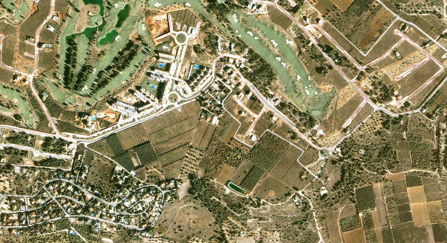
This documentation captures the territorial transformation of the Mas Camarena district in Valencia over a decade-long period. The visual evidence illustrates the substantial landscape modifications that occurred in this area between the early 2000s and the early 2010s.
2002
2012
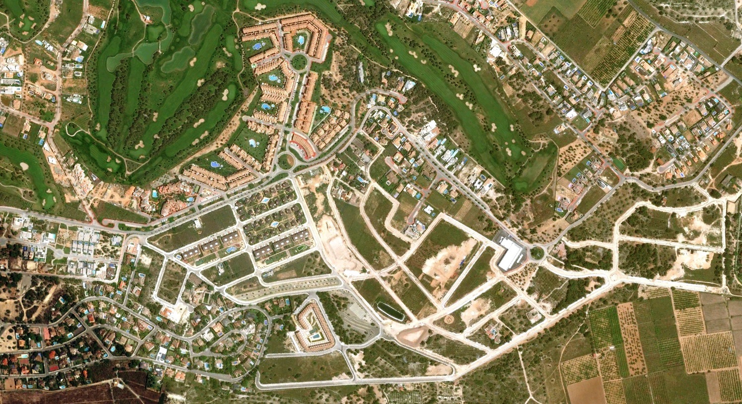
The comparative aerial imagery reveals the extent of urbanization processes affecting this former agricultural zone. What was previously characterized by open fields underwent significant residential and infrastructure development during Spain's construction expansion period.