The satellite imagery sequence documents territorial modifications in Olivenza, located in the province of Badajoz. The comparative analysis reveals infrastructure development and land use alterations occurring between 2004 and 2011.
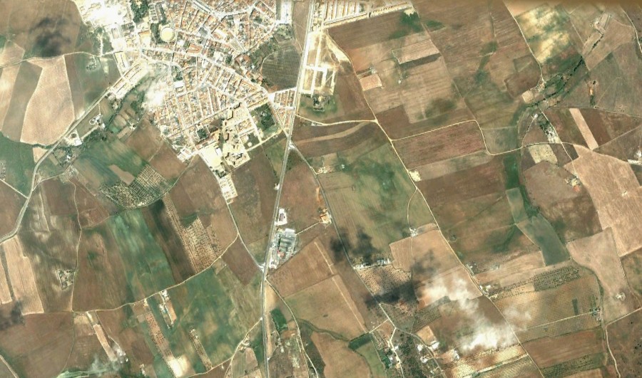
Initial state: 2004
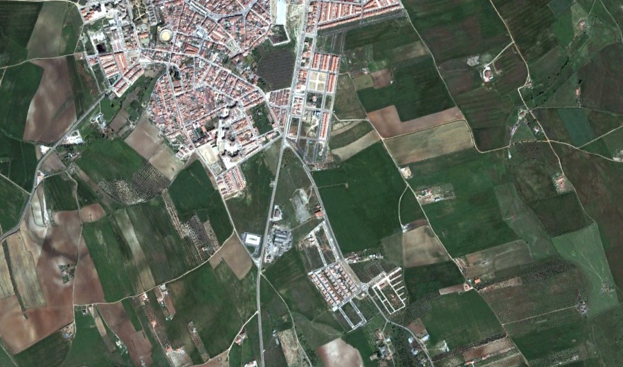
Subsequent state: 2011
The photographic evidence captures the emergence of new road infrastructure, including circular traffic intersections, alongside modifications to the surrounding landscape. This visual documentation serves as a record of urban expansion patterns during this seven-year period in this border municipality.