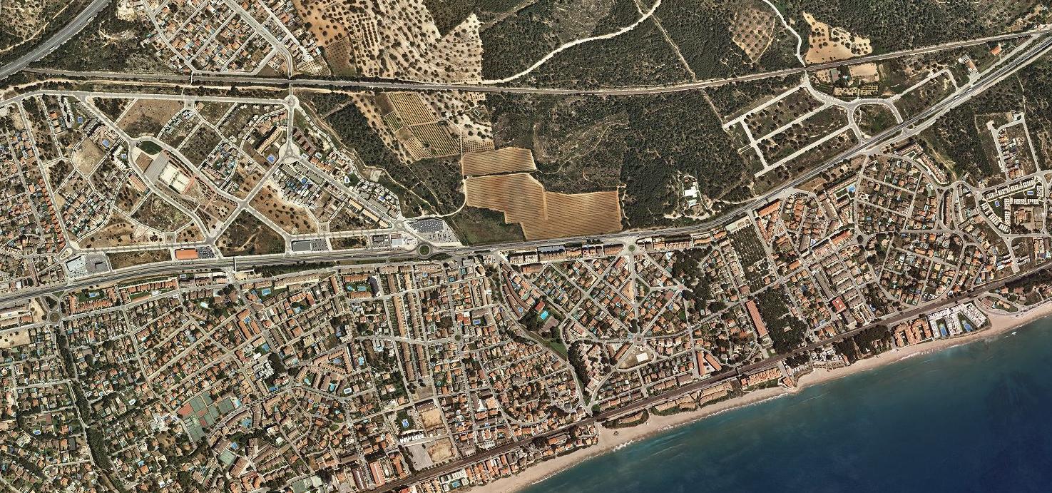
This visual record documents the transformation of Roc de Sant Gaietà on the Tarragona coast. The comparative imagery captures the shift in land use patterns between the year 2000 and 2015, revealing significant changes in the built environment and infrastructure development along this Mediterranean coastal section.
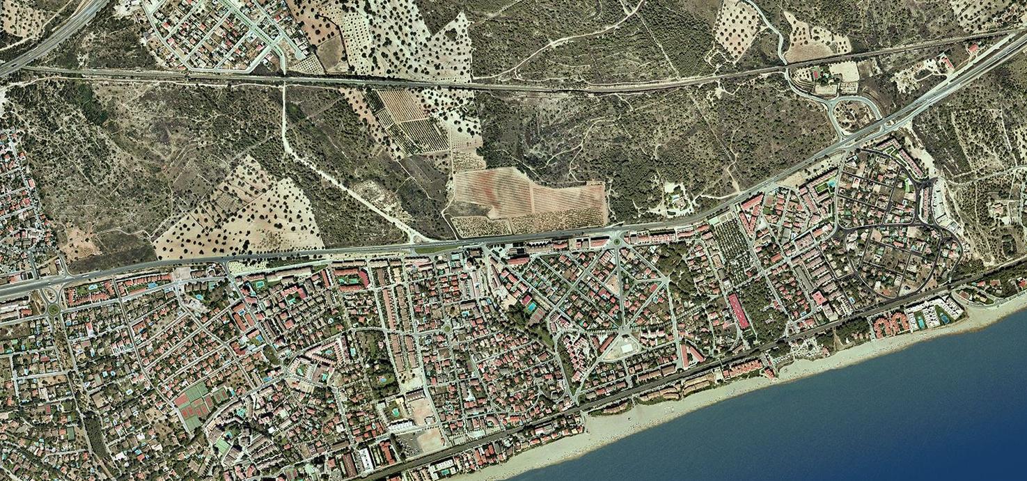
2000
2015
The documentation shows the emergence of new development structures and road networks where previously undeveloped terrain existed. This transformation is characteristic of the broader territorial changes observed across Spain's coastal regions during this fifteen-year period.