This visual comparison documents the transformation of the Las Tablas and Sanchinarro districts in northern Madrid between 1999 and 2014. The images reveal the extensive urban expansion that occurred during this fifteen-year period, converting agricultural and undeveloped land into densely populated residential neighborhoods.
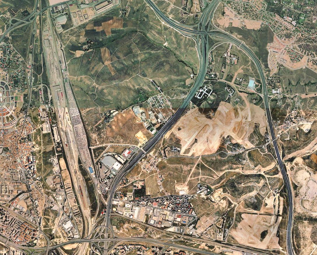
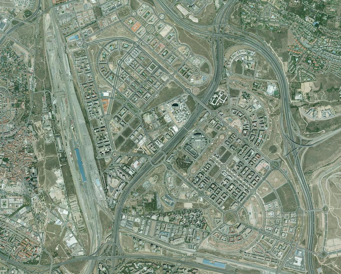
The before image captures the landscape as it appeared in 1999, while the after image shows the same area in 2014 after complete urbanization. This development represents a significant example of the territorial changes that occurred across Spain during the period of rapid urban expansion.