This visual documentation captures the territorial transformation observed in the Santa Isabel area of Zaragoza over a ten-year period. The imagery presents a comparative analysis of landscape changes between 2001 and 2011, revealing patterns of suburban development and infrastructure expansion characteristic of early 21st-century Spanish urban growth.
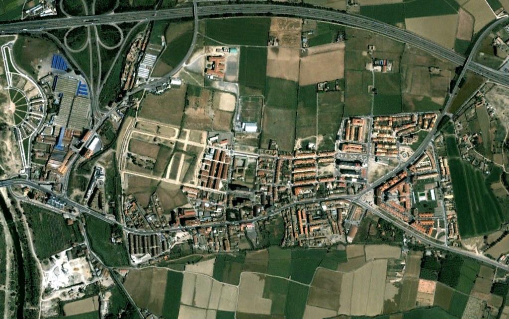
2001
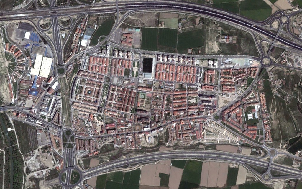
2011
The photographic evidence documents the conversion of previously undeveloped terrain into urbanized zones, featuring residential construction, road infrastructure including characteristic roundabouts, and the reconfiguration of land use patterns typical of peripheral suburban expansion during Spain's construction boom.