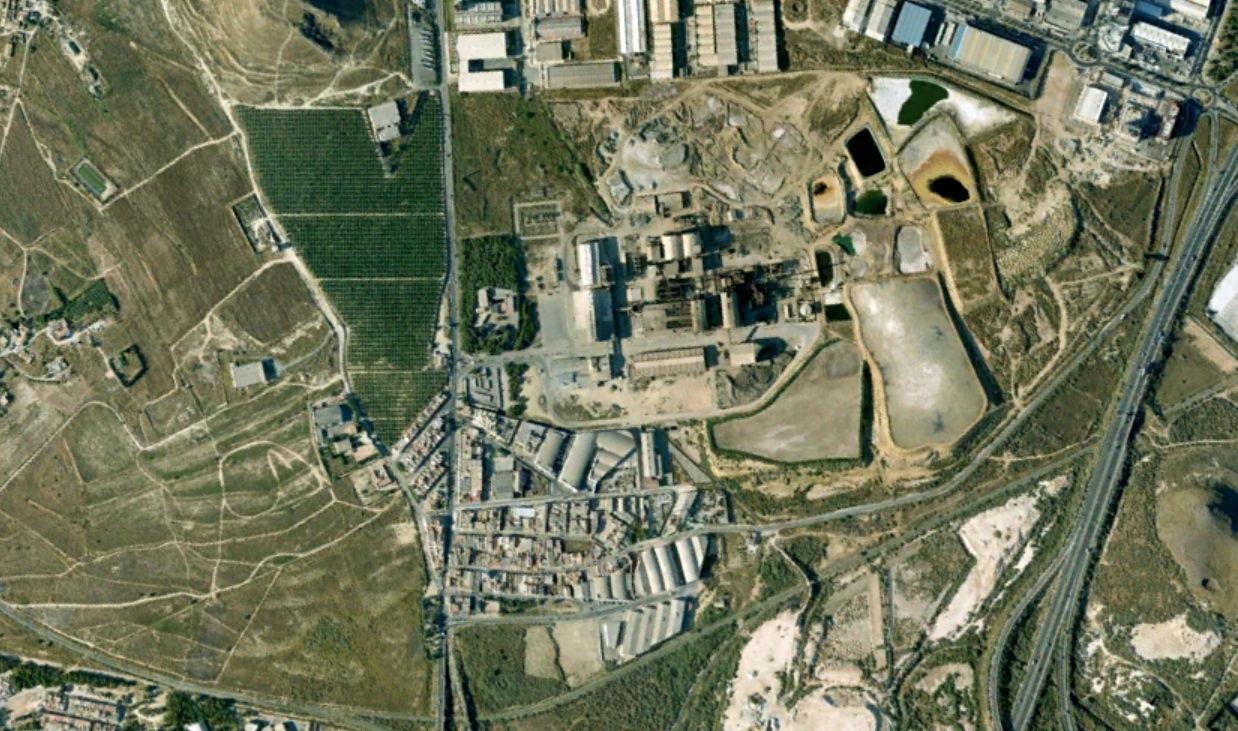
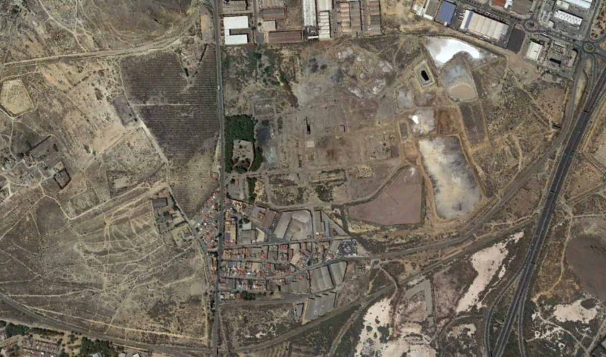
This visual documentation captures the transformation of Torreciega, a coastal area in Cartagena, Murcia, over an eleven-year period. The imagery reveals significant shifts in the territorial character of this industrial zone.
Between 2007 and 2018, the landscape underwent notable changes reflecting broader patterns of deindustrialization and infrastructure development. The photographs document how industrial facilities gave way to new road networks, including the construction of roundabouts that have become characteristic features of contemporary Spanish urban expansion.
The visual evidence presents the evolution of land use in this Mediterranean coastal region, showcasing how former industrial terrain has been repurposed through transportation infrastructure projects. These changes illustrate typical patterns observed across many Spanish territories during this period of urban reconfiguration.
No Comments
Be the first to share your observations about this territorial transformation.