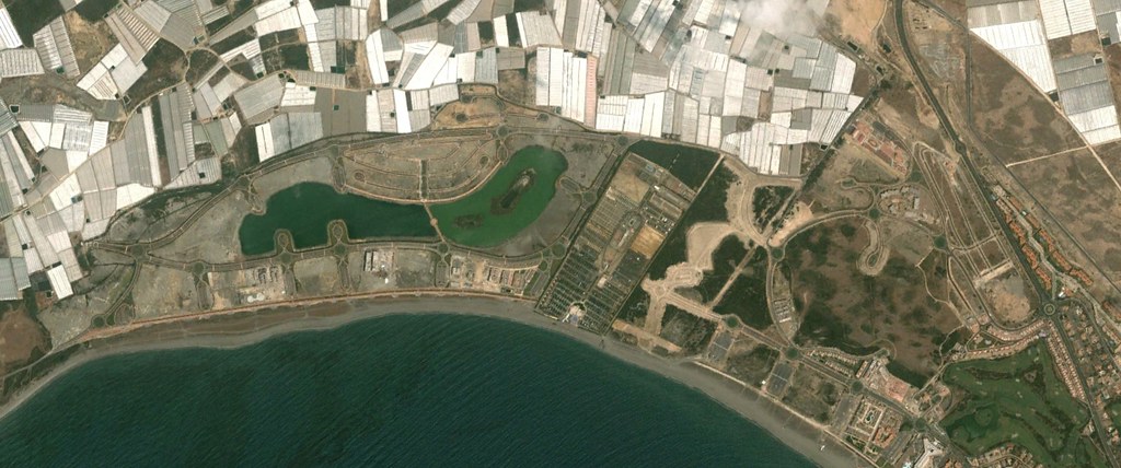
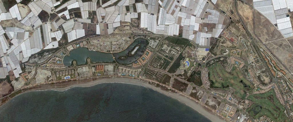
This comparative aerial documentation captures the coastal expansion of Almerimar, a planned resort development in the province of Almería. The imagery reveals the transformation of agricultural and undeveloped coastal terrain into a residential and recreational complex over a ten-year period.
The earlier photograph documents sparse development adjacent to existing marina infrastructure. The landscape displays characteristic Mediterranean coastal features with limited built structures dispersed across the terrain. Agricultural plots and natural vegetation patterns dominate the visual frame.
The subsequent image records substantial infrastructural changes. New residential zones emerge along gridded street networks. The development extends outward from the marina core, incorporating roundabouts and multi-lane roadways that reorganize the territorial circulation system. Golf course greens introduce manicured landscapes where agricultural land previously existed.
These visual records document the physical manifestation of Spain's coastal development patterns during the early 21st century, illustrating the conversion of rural coastal landscapes into urbanized resort complexes designed for permanent and seasonal residential occupation.