This comparative analysis documents the transformation of the landscape in Domeny, located in the province of Girona. The visual evidence captures the extent of territorial change over a thirteen-year period, revealing patterns of urban expansion and infrastructure development typical of the Spanish construction boom.
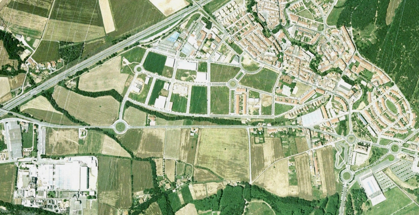
2002
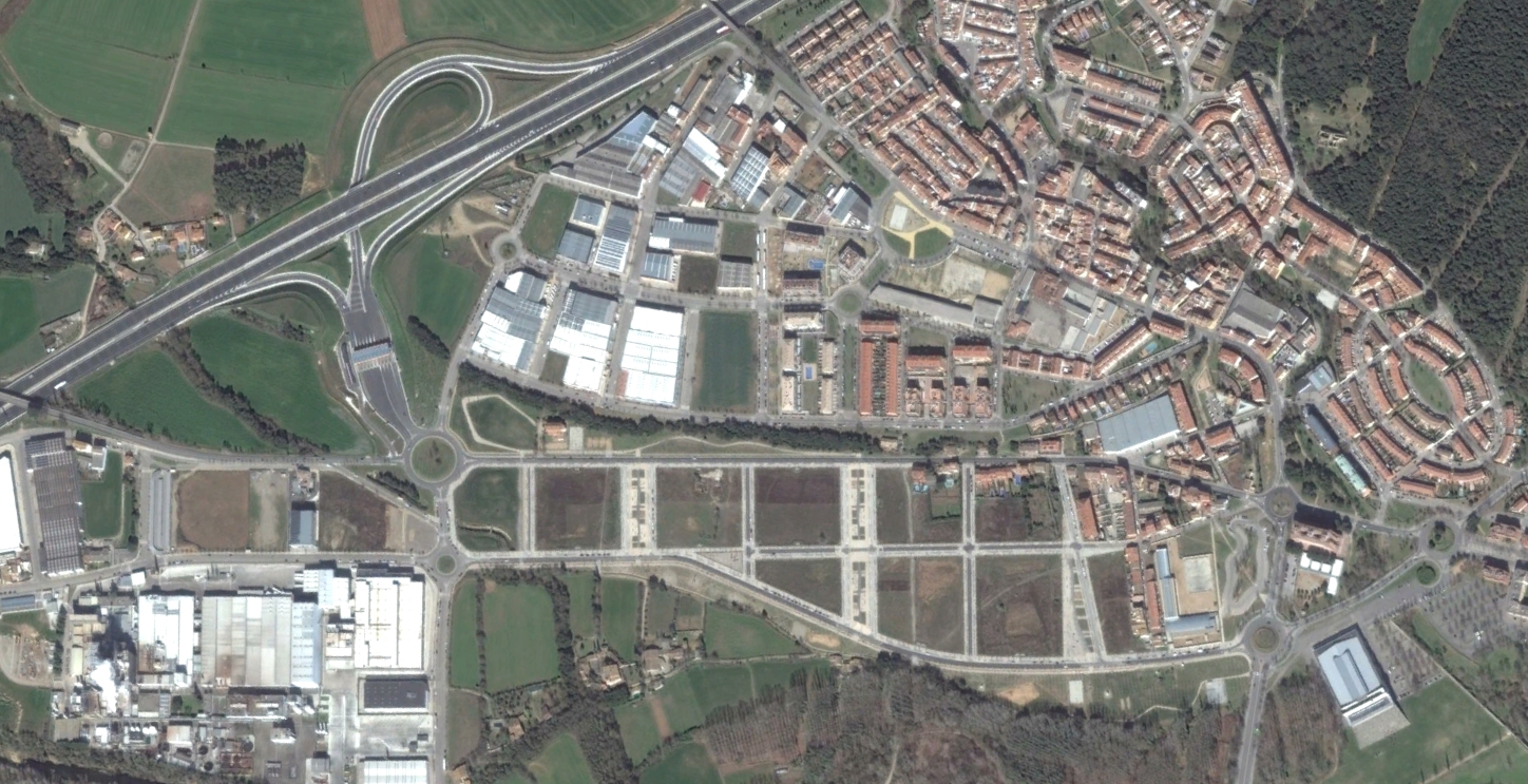
2015
The before-and-after imagery illustrates the significant modification of what was previously agricultural terrain. New road infrastructure, including roundabouts characteristic of the period, intersects the developed zones. The documentation serves as a record of how Spanish municipalities underwent rapid transformation during the early 21st century.