This visual documentation captures the transformation of terrain in Gójar, a municipality in the Granada metropolitan area, over an eight-year period from 2004 to 2012.
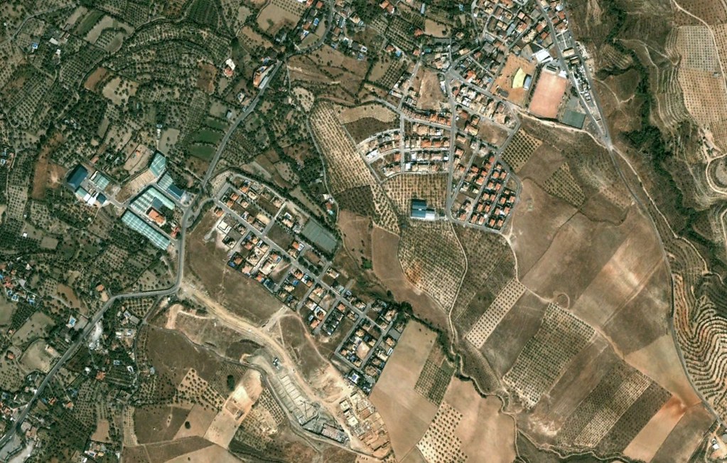
2004: Agricultural landscape dominates the area
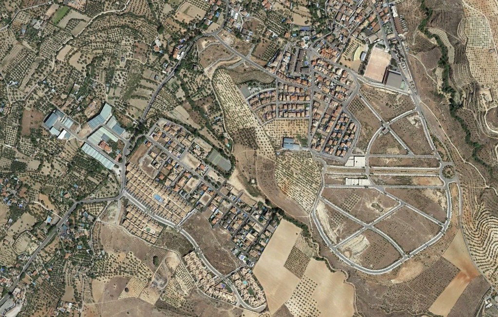
2012: Infrastructure and built environment have replaced open fields
The imagery reveals the extent of land use conversion during the Spanish real estate expansion period, documenting how previously undeveloped zones underwent significant urbanization.