This visual comparison documents the landscape transformation observed in the Rosalejo area of Málaga province between two distinct time periods. The imagery reveals notable changes in land organization and surface treatment patterns over an eight-year interval.
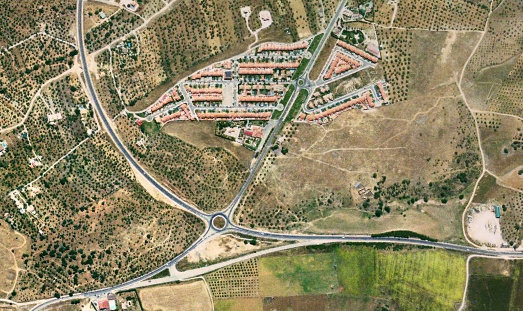
2004 perspective: The earlier documentation shows the territory in a predominantly unaltered state, characterized by natural surface patterns and minimal infrastructure intervention.
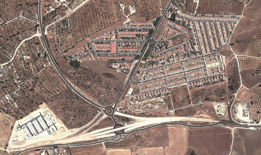
2012 perspective: The subsequent imagery reveals the emergence of constructed elements including transportation infrastructure and altered ground surfaces. The transformation illustrates typical development patterns observed across similar geographic contexts during this period.
These paired observations serve as visual evidence of how territorial organization evolved in peripheral areas during the early 21st century development cycle.