A visual examination of territorial modification in the municipality of Melianta within the province of Girona documents landscape changes between 2004 and 2015.
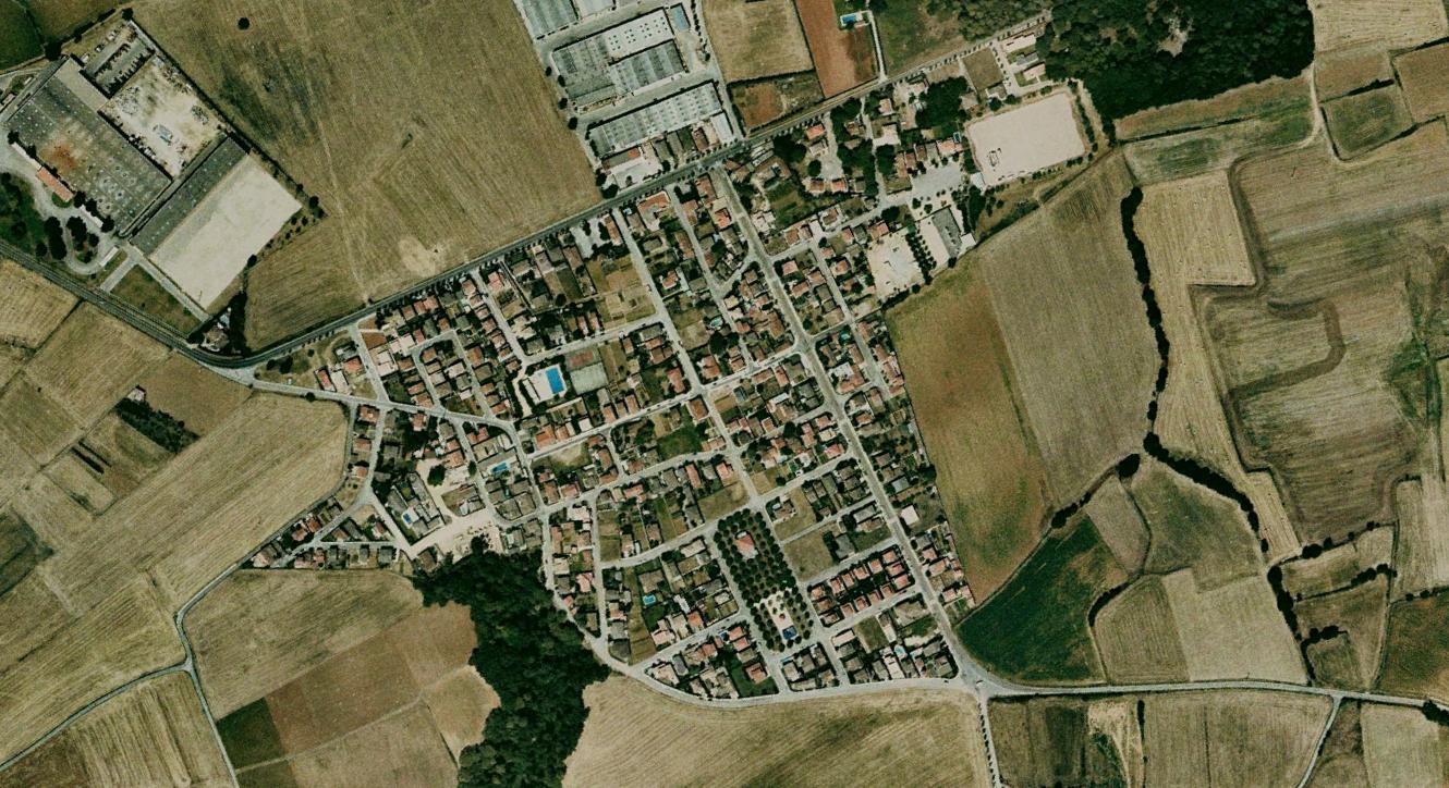
2004 aerial documentation
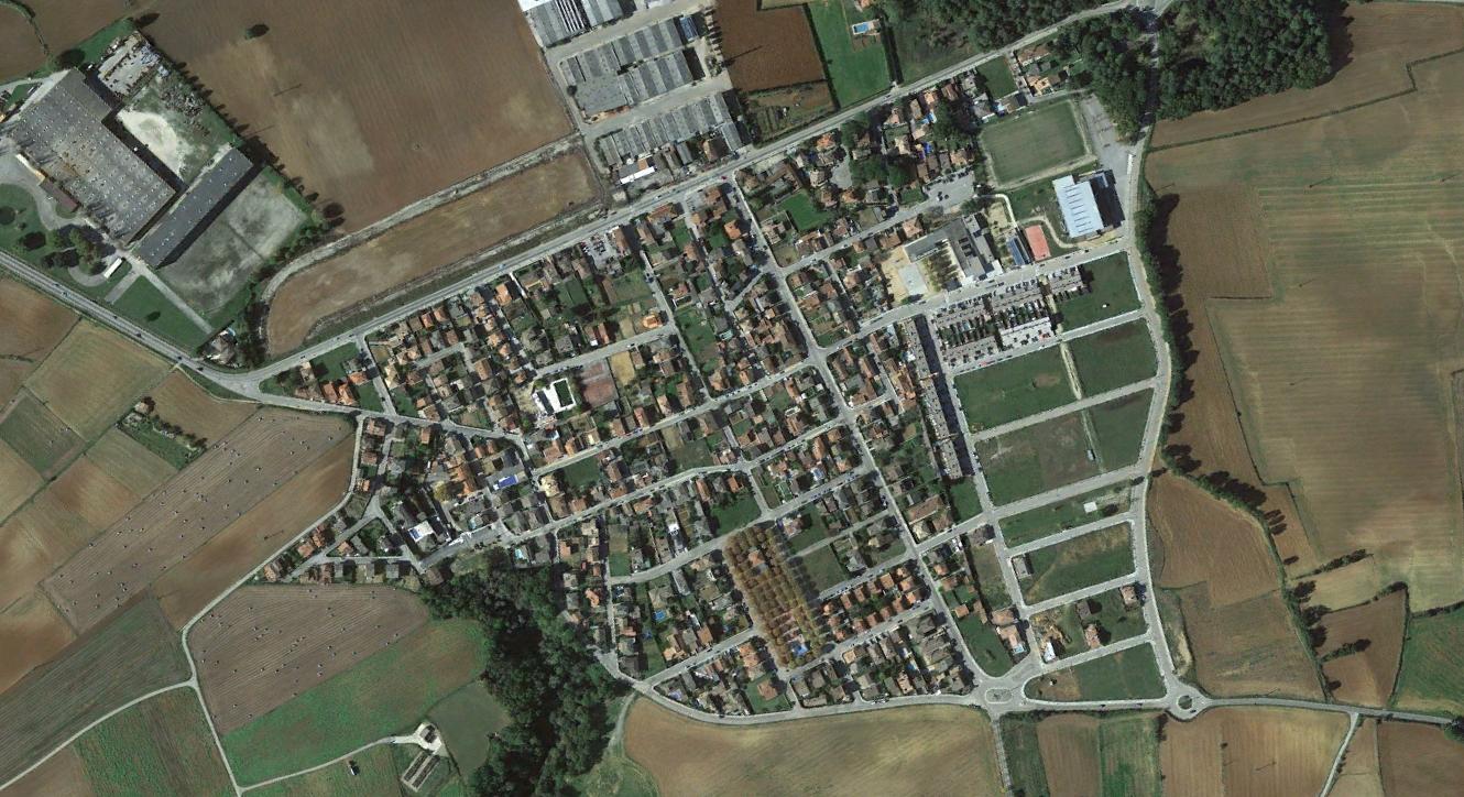
2015 aerial documentation
The comparative imagery reveals infrastructure development and alterations to the regional landscape over the eleven-year observation period.